How a photograph becomes a measurement
The drone flies the property in parallel lines, shooting continuously. Each photograph shares 70 to 80 % of what it sees with the next one, and 60 to 70 % with the line alongside. That overlap is not waste: it is the method.
With that much repetition, a single point on the ground —a rock, the corner of a fence— appears in ten or fifteen photographs taken from different positions. The software recognises it in all of them and works out where it sits in space by triangulation. It is what your two eyes do to give you depth, with hundreds of photographs instead of two.
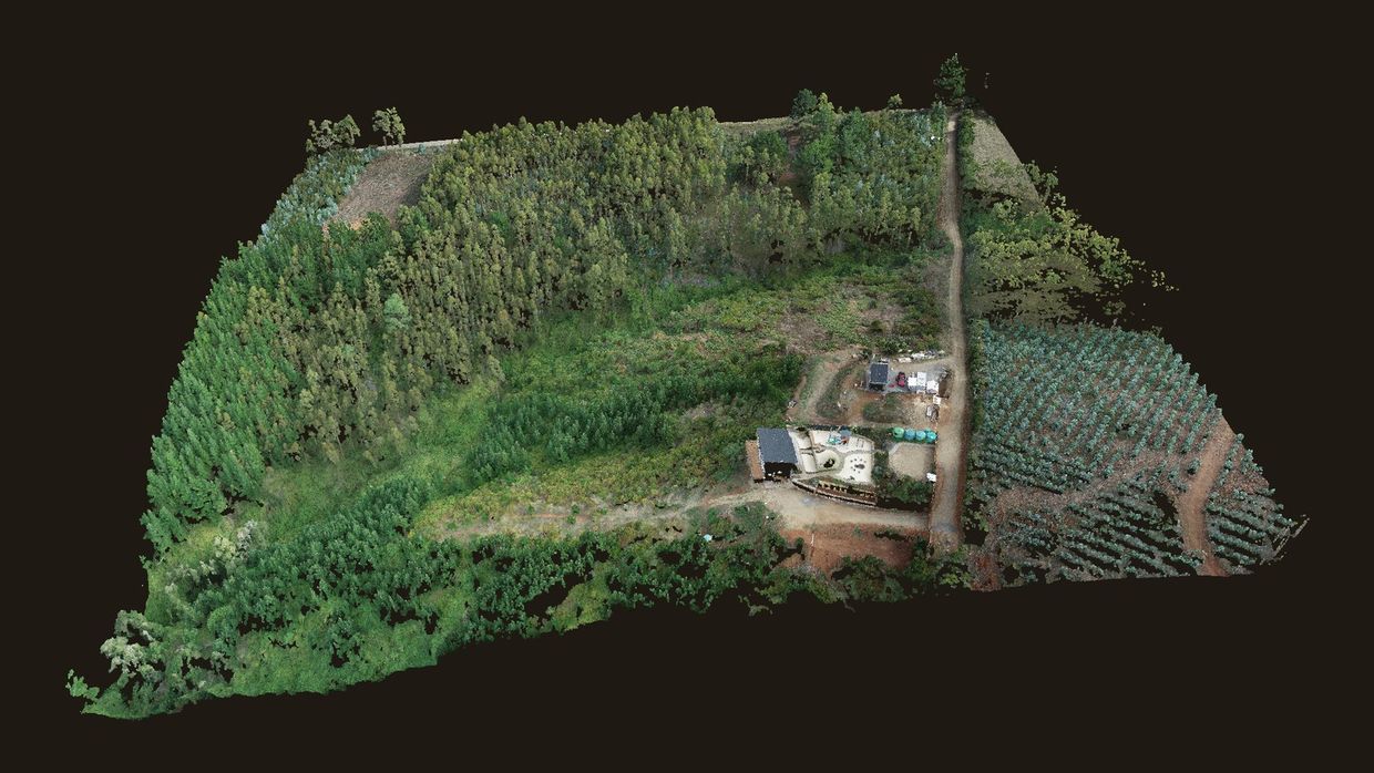
The result is a cloud of millions of points with X, Y and Z coordinates: the shape of the land, rebuilt without setting foot on it.
Why the flight alone is not enough
That cloud is exact with respect to itself, but it floats. It knows one point sits twelve metres below another; it does not know where it sits in Chile.
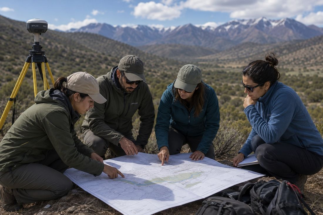
Tying it down is the job of the geodetic GNSS receiver. Control points are marked across the property, measured on the ground with the receiver, and the whole model is anchored to those coordinates. Without that anchor you have a faithful scale model; with it, a survey.
So the flight never goes alone: without ground control there is no survey. The reverse does not hold —the geodetic receiver is used on its own for work that needs no flight— but an aerial photogrammetric survey always carries both.
Flight height decides the detail
Each pixel in the photograph covers a patch of ground. That figure is the GSD , and on survey work it runs between 1 and 5 centimetres per pixel.
Flying lower shrinks the pixel and raises the detail, but multiplies the lines, the photographs and the time. And there is a ceiling worth knowing: final accuracy never gets better than one or two times that pixel, however good the control points are. It is a property of the method, not of the equipment.
So the height is chosen from what has to be measured. A boundary and a building platform do not ask for the same thing.
What you end up holding
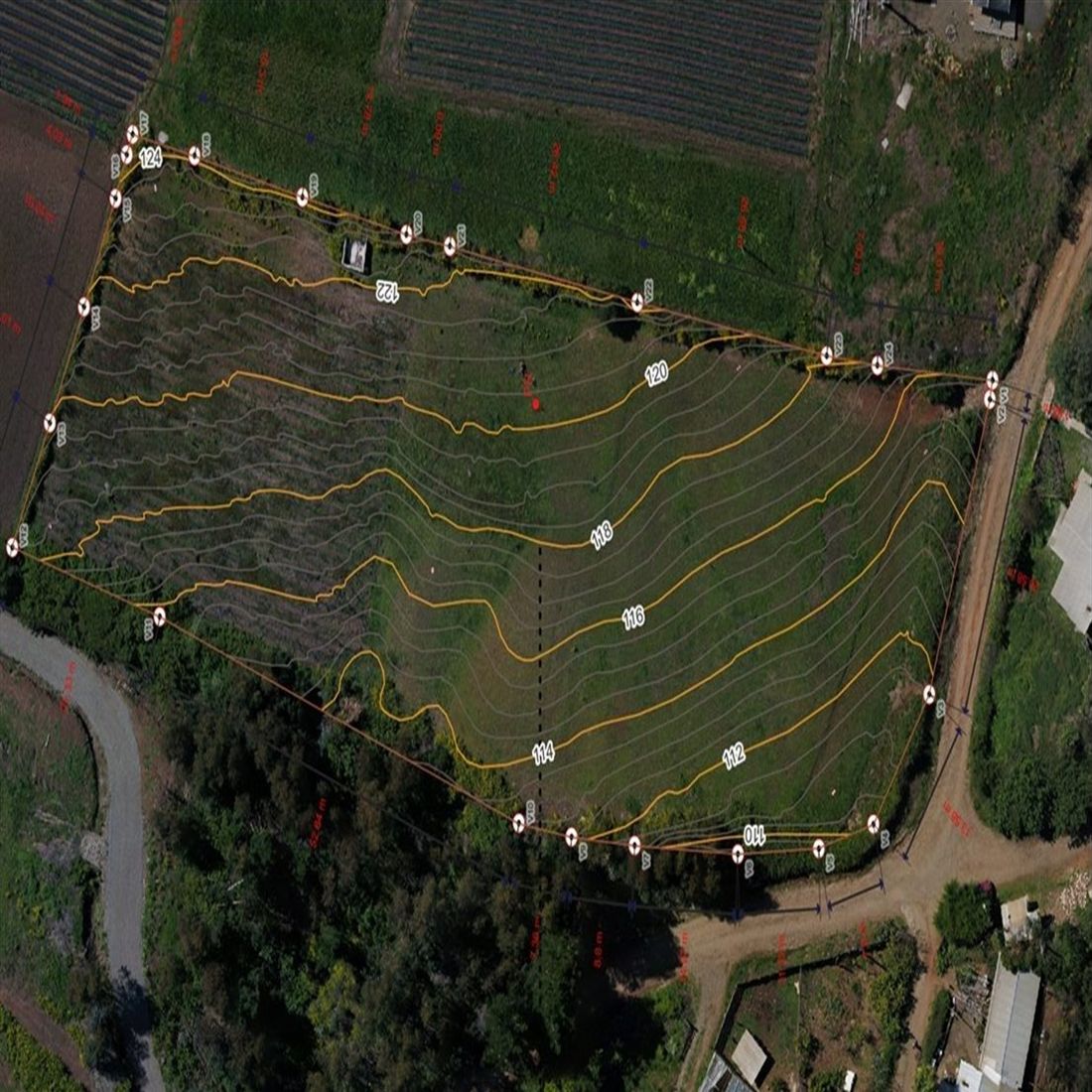
Orthomosaic. The aerial photograph of the whole property, corrected so you can measure on it as you would on a plan.Contour lines , at whatever interval the terrain calls for.Digital terrain model. The shape of the ground, for calculating slopes, runoff and volumes.Point cloud. On our surveys you can walk through it in the browser, with nothing to install.
What is not ours to do, and worth knowing
Photogrammetry only rebuilds what the camera can see. Under dense canopy the ground appears in no photograph at all, so there the model does not measure it: it estimates it between the gaps.
On grassland, low scrub or open woodland that is not a problem. In closed forest, the ground level under the trees has to be taken with reserve, and if the project depends on that figure it is complemented by measuring on the ground.
We would rather say it beforehand than afterwards.
Does this apply to your land? The first conversation is exactly where that gets settled.
Book a call
What sets it apart from the GPS in a phone
A geodetic receiver listens to several constellations on two frequencies and corrects its position against a reference base while it measures. Where the GPS in a phone stops at several metres, this one gets to centimetres.
The correction can arrive in more than one way. With RTK it arrives in real time and the point is accepted in the field; it can also be applied afterwards, on the raw data. Which one is used depends on the coverage available on the property and on the accuracy the job asks for.
When it travels with the flight
First, marking and measuring the control points that tie the flight down. Spread across the property, they are what turn the drone's cloud into a georeferenced survey.
Second, taking directly what the camera cannot resolve: a vertex under a tree, the floor of a narrow ravine, an existing boundary marker that has to be respected.
An aerial photogrammetric survey never goes without this: with no control points, the drone's cloud is exact with respect to itself but sits nowhere.
When it goes on its own
The relationship is not symmetrical, and it is worth being clear about it when asking for a quote: the flight always needs the ground control, but the geodetic receiver does not always need the flight.
There is work that is settled entirely with the receiver. Setting out : taking the points of an existing plan back to the ground, to lay out a road, a boundary or the platform for a house. Perimeter-only measurement , when all that is wanted is the fence line and the area it encloses. And spot corrections on a survey that already exists.
These are tighter and faster jobs than a full survey. If that is what you need, there is no sense in you paying for a flight.
What you end up holding
Control points measured and documented, which is what makes the survey verifiable.Vertices and boundaries with coordinates, ready for the plan.Points set out and marked on the ground, when the job is taking a plan back to the site.Spot levels where the flight does not reach the necessary quality.
What is not ours to do, and worth knowing
It needs to see sky. Under closed canopy, against a high cut or between walls, the signal degrades and the point loses quality — and the equipment says so before storing it.
In those places we measure another way. A bad point is never forced through just to avoid leaving the box empty.
Does this apply to your land? The first conversation is exactly where that gets settled.
Book a call
Surface and terrain are not the same thing
What the flight delivers first is a surface that includes everything standing up: trees, roofs, fences, the parked car. That is the digital surface model , and it is good for some things.
Filtering out what is not ground leaves the digital terrain model : the shape of the bare earth. It is on that one that slopes, runoff and earthworks are calculated.
What it is used for
From it come the contour lines, the slope map —where you can build and where you cannot—, the path the water takes when it rains hard, and the cut and fill volumes of a road or a platform.
It is the product almost every design decision downstream hangs from.
What you end up holding
Digital terrain model in a working format, not only as an image.Contour lines derived from it.Slope map , when the project calls for one.
What is not ours to do, and worth knowing
The filtering is only as good as the ground points that exist. Where the canopy covers the ground completely there is nothing to filter and the surface is interpolated between the gaps.
It is the same limit as aerial photogrammetry, inherited: the model cannot know what the camera never saw.
Does this apply to your land? The first conversation is exactly where that gets settled.
Book a call
Stage 02 · Design
Subdivision and lot layout
Splitting a property is not sharing out square metres. It is deciding where the road comes in, how far the services reach, and what is left untouched.
The law fixes the rules; the rest is what is left to decide
On rural land the base rule of Chile's DL 3,516 is that no resulting lot may fall below half a hectare —5,000 m²— with narrow exceptions the law itself lists, and that every lot must be left with access to a public road.
That is the floor, not the project. Meeting the minimum is a calculator's job. What decides whether a layout works is where the lines fall: which lot keeps the view, which the best soil, which inherits the awkward slope, and where the road that links them all runs.
One property can fall under two regimes at once
If the land crosses a line on the zoning plan there is not one procedure but two, and they are nothing alike. The part in rural land falls under DL 3,516 —lots of half a hectare minimum— and is certified by the agricultural service, SAG . The part inside an urban extension zone falls under the General Urbanism and Construction Act and its ordinance, and is resolved by the municipal works department with verification by the regional housing ministry.
Different bodies of law, different authorities, different files. When both apply, they are prepared and filed in parallel, so that every lot ends up registered and rolled within a single process rather than in two rounds.
Knowing in advance which regime each part of the property falls under is what stops you designing a layout that cannot afterwards be approved.
Four decisions taken only once
The arrangement. The whole before the lot: how they are ordered among themselves and how they sit with what already exists around them.
Services and waste. Water, power and sanitation have routes of their own, and those routes govern where each house can go. Solving it afterwards is expensive and it shows.
Reforestation. Rural tree cover and transition woodland between lots: what in time gives shade, breaks the wind and separates without a wall.
What is not subdivided. Conservation, remediation and regeneration areas. On almost any property there are stretches worth more intact than split.
What it is drawn and designed on
The layout is drawn on the survey, not on the title deed. Real surface area, slopes and the way water runs are what say which lot is viable — and on properties with old deeds we have seen gaps of up to 20 % between paper and ground.
We handle the paperwork
The job does not end at the drawing. We file the applications with whichever bodies apply, answer the observations they raise and follow the process through until every resulting lot is registered and carries its own tax roll number at the Internal Revenue Service .
The application is filed under the sponsorship and signature of a qualified professional, and on our commissions that signature is Fernando Montoya Giordano's, urban architect . It is the one the rules ask for on a rural subdivision, and we have it on the team.
What you end up holding
General subdivision plan in the format and with the particulars each authority requires.One drawing per resulting lot , with its UTM coordinate schedule, surface area, boundaries and easements.Access and right-of-way layout , which is what makes the lots usable and not merely legal.The filing carried through : certificate or resolution depending on the regime, lodging of the plans at the property registry and tax-roll registration.
What is not ours to do, and worth knowing
We do the filing; the fees are not ours. SAG charges, municipal duties, property-registry fees and notary costs are the owner's. We do not fold them into the price because they are not ours to charge.
Review times are set by the authority. Our part —fieldwork, project, drawings and lodging the files— carries a committed deadline. How long the review then takes depends on the office doing it, and nobody controls that from outside.
If title comes from an unsettled inheritance, there is another road first. Probate, the special inheritance registrations and, where it applies, the deed of partition. That one is a matter for a lawyer and a notary, and it goes separately: we say so at the start and not halfway through.
Does this apply to your land? The first conversation is exactly where that gets settled.
Book a call
Stage 02 · Design
Property design and general planning
This is the planning of the property according to what the owner needs and the context it sits in; where the house goes, where the road comes in and how the water runs are decided once. Everything else arranges itself around that.
The water sets the order: the ground rules, not the drawing
Before anything is designed we look at where the water runs across the ground when it rains hard, where it pools or waterlogs and where it dries first. That reading orders the rest: the house does not necessarily go where the view is best if that is precisely where the water comes down.
Then access, routes and orientation. A platform at the wrong level is paid for in earthworks, and a badly routed track erodes every winter.
Zoning is deciding what does not go where; it is matching zones to uses and spotting the conflicts they may cause later: the woodshed is handy close by, but is it safe if a fire comes?
The property is divided into zones of use: what is built, what is productive, where movement happens, what is left untouched. It is not filling a plan with colours; it is deciding properly where each thing may appear later on.
That is where the planning pays for itself: the extension that arrives five years in either fits or does not, depending on what was decided now.
You design it with us
The process is participatory with the owners and staged, with site visits and approvals along the way: a draft zoning and use proposal, joint working visits, and whatever objections, changes and approvals come out of them.
It is not a courtesy, it is our method. Whoever is going to live on the property knows things that appear in no survey.
What you end up holding
Property planning drawing with the zoning and the uses.Siting of existing and future buildings: house, access, platforms.Water routing : where it drains, where it infiltrates, where it gathers.
What is not ours to do, and worth knowing
This is property design, not an architectural project or structural calculation. We define where the house goes and on what grounds, not how it is built.
The building permit is another matter and it is another professional who sponsors it. We say so up front because it is sometimes assumed to be included.
This is the stage where almost everything is decided. What follows —landscape, works, planting— are consequences of it.
See the full method
Does this apply to your land? The first conversation is exactly where that gets settled.
Book a call
Stage 02 · Design
Functional landscaping
It is a kind of landscaping that works functionally, holding a conversation — sometimes an argument — between what gets built and the natural space. In short, it is the right relationship between natural geography and human geometry, at a scale a person can inhabit, in a place that is not only beautiful but productive, protective and regenerative. In practice it means every decision is justified by more than one reason. A hedge is not only there to look well: it breaks the wind, marks a limit and, if the species is chosen with judgement, it is not fuel.
We get there by drawing on at least these four disciplines.
Landscape design. Composing space as it is perceived and experienced day to day.
Agroecology. Soil productivity kept in balance with the wider ecosystem.
Permaculture. Systems designed to sustain and regenerate themselves over time.
Firescaping . Landscape designed to reduce wildfire risk.
None rules the others. What makes a project functional is that all four are on the table when it is decided what gets planted and where.
The planting palette is counted
The proposal arrives with the species defined and counted, not merely described along with their traits and management. From that come a preliminary budget, a work plan and a support programme that can be set out by stage and by season.
A planting drawing without those definitions is a picture. With quantities it is something you can price, build in parts and even postpone without losing the whole.
What you end up holding
Planting drawing with the palette defined and quantified.Preliminary budget worked out on those quantities.Work plan by stage and season.Support programme while the landscape establishes.
What is not ours to do, and worth knowing
A garden, whatever its size, is not handed over finished: it is handed over established. The first years ask for watering, replacement and management, and the project does not solve that.
Not every species you may like survives where you live. When the handsome choice and the viable one do not coincide, we say so before planting.
Does this apply to your land? The first conversation is exactly where that gets settled.
Book a call
Setting out is the survey in reverse
In a survey the ground goes into the drawing. In setting out the drawing comes back to the ground: the points of the project are taken and marked on site with geodetic GPS, one by one.
The centreline of a road, the vertices of a boundary, the corners of a platform, the run of a ditch or a pond. What on paper is a line, on the ground is stakes and set-out lines.
Corrections are part of the work, not a surprise
The ground always corrects something. Rock turns up where the footings have to go, the soil gives where the drawing called it firm and stable, or a tree worth keeping stands right on the line of the fence.
Adjusting that on site and recording it is what stops the drawing or the project and the works telling different stories. The correction is noted and the drawing updated, otherwise in five years nobody will know which of the two was true.
When corrections are worth making
Whenever there are works to build on a project that is already defined. Also when someone else is building: the drawing being set out does not have to be one of ours.
What you end up holding
Points marked on the ground , referenced back to the drawing.A record of the corrections made, and why they were made.An updated drawing showing what was actually built.
What is not ours to do, and worth knowing
We set out and we record. Building the works can be ours in part or in whole, or go with whoever you choose: they are separable, and sometimes separating them is the right call.
Temporary stakes do not last. Once it is marked, the layout has to be built properly; if that slips by months, it will probably have to be set out again.
Does this apply to your land? The first conversation is exactly where that gets settled.
Book a call
Stage 03 · Delivery
Boundaries and living fences
A limit that lives and grows separates just as a fence does, and on top of that it holds and improves the soil, breaks the wind, looks well and gives shelter.
Why a living fence and not just wire
A post-and-wire fence marks the limit and its work ends there. A living fence designed by us does the same and over the years adds at least four things: it regulates the wind, gives shade in summer and sun in winter, holds and regenerates the soil, and works as a corridor for the birds that spread its seed.
It also ages the other way round from wire: one rusts open, the other closes in.
Where each species goes is not trivial
Not every fence on a property does the same job. The perimeter one defines the boundary and usually needs wire as well as planting. The internal ones separate uses, the productive from the lived-in, the run of animals, and there a living fence or hedge of low or medium height works on its own.
And there are stretches where the point is to break the wind: those are planted as a band rather than a line, with stepped heights.
The boundary rules, and it is worth measuring first
In the countryside there is an unwritten rule: the old fence rules . When the paper and the actual occupation differ, what gets respected is usually the one that has stood for decades.
So a new fence is set out on the survey, not on the one that was there. Planting a living fence on the wrong line is a mistake that takes years before it can be corrected.
What you end up holding
The fence line set out on the survey.Species and spacing defined stretch by stretch, according to what each stretch has to do.A management plan for the first years, which is when it is decided whether the fence closes or not.
What is not ours to do, and worth knowing
A living fence is not immediate. Depending on species and site, closing takes from two to several years, and in that time it has to be watered and whatever failed to establish, for whatever outside reason, replaced.
If you need to hold animals from day one, wire goes in as well. The living fence does not replace it while it grows.
Does this apply to your land? The first conversation is exactly where that gets settled.
Book a call
Stage 03 · Delivery
Bio-filters and bio-ponds
So that the water leaving the house, or running off when it rains, comes back to the property in the right condition to be used again.
What a bio-filter is
A constructed wetland: a planted filter bed that water enters by gravity and leaves clean. It is filtered first by mechanical means; then the roots carry oxygen into the bed and micro-organisms break down the organic matter.
It is sized for one house or for a group of them, and hardy species grow on the bed, bulrush, reeds, papyrus, which also keep it from looking like a sanitary installation.
Greywater, which is most of it
What leaves showers, basins and the laundry sink is greywater: a lot of volume and little load. It is the fraction that makes most sense to treat on the property, because it is the one that can go back into use, for irrigation for instance.
Treating it instead of sending it to the pit does two things: it takes load off the sanitary system and returns water to the ground, which on dry land is no small matter.
The bio-pond is the same thing to another end
A naturalised pond holds water and keeps it alive: edge planting, varying depth and some circulation. It is not a swimming pool and not a reservoir; it is a store that also works as habitat.
Where to put it is a decision with two sides. Low on the slope the water arrives on its own and more of it gathers: the pond works with the ground. But using it afterwards means lifting it, and lifting water means a pump. Higher up less gathers, and in exchange it comes down on its own to wherever it is needed, with no energy. Which of the two suits you depends on the property and on what the water is for, and we decide that with you.
What you end up holding
Sizing based on the number of people and actual use, not on a catalogue.Design of the bed and the planting , with species that hold up on the site.The works built , and the management notes for the first months.
What is not ours to do, and worth knowing
A bio-filter treats greywater . Blackwater is another system and another regulation: we do not put this forward as a replacement for a septic tank.
It needs fall to work by gravity and room for the bed. On flat or very tight ground you have to pump, and then it is worth checking whether it still pays.
It needs management afterwards: cutting back the planting and checking the filter. It is little work, but it is not none.
Does this apply to your land? The first conversation is exactly where that gets settled.
Book a call
Land survey
We hand you the information. You make the decision.
On every property we have surveyed whose deed is an old one, the real surface area has never matched the declared figure. The differences reach 20 %, and they run both ways: plots that come out smaller than the paperwork claims, and others considerably larger.
On a 5,000 m² plot, 20 % is 1,000 square metres. That is a difference you pay for, build on, or lose.
You do not need to have bought yet. Several clients ask us to survey before they sign, precisely to know what they are buying. More than one has taken that figure into a price negotiation.
There is an exception, and it is worth saying. Recent subdivisions do match: they are measured with precise instruments and the deed reflects the surface area well. If the property comes from a recent parcelling, the figure is probably right — and the survey earns its keep elsewhere: slopes, water, access, where you can actually build.
The gap shows up in everything else: inherited land, subdivisions from decades ago, boundaries that were never measured again.
We do not raise this to alarm anyone, but because it is the figure almost nobody has on the table when they sign.
Why the paperwork and the ground drift apart
Many deeds come from old measurements, taken with methods that lacked today's precision. Others were inherited and never checked again. And a good share describe boundaries by landmarks —the creek, the big oak, the track— that shifted or vanished over the years.
On top of that sits an unwritten rule everyone in the countryside knows: the old fence wins . When the paperwork and the actual occupation disagree, what tends to be respected is the one that has stood for decades, not the line on the plan.
The reason is practical rather than legal. Moving a fence is a cumbersome procedure, and in most cases it works out better to correct the surface area on paper than to open a dispute with the neighbour . That is what almost everyone chooses once they find out in time.
It is not a rule: each case is settled separately. Where the neighbour agrees, we can carry the surface-area correction as far as the property registry; where they do not, the route is judicial and that commission belongs to a lawyer. It is worth knowing before you sign rather than after.
So we measure the land as it stands: its real surface area, its boundaries and the line the fence actually runs along.
What the exact number changes
The price. If the land trades by the square metre, that gap carries straight over into what you pay. Walking into the negotiation with the measurement done is not the same as doing it on an impression.
Whether the project fits. Minimum subdivision size, setbacks and where the house goes are all calculated on real metres. What works on paper may not work on the ground.
The boundary with the neighbour. Finding the discrepancy with the survey in hand, before buying, is very different from discovering it the day someone decides to move a fence.
The access. The right of way on the deed and the track people actually drive in on are not always the same.
In none of these cases do we decide for you. We hand you the figure, and the decision is yours.
How we measure it
We fly the property with a drone and tie it to points taken with geodetic GPS. The two techniques are complementary and work together: the flight covers the whole surface, the ground control gives it exact coordinates.
The result has centimetre precision . From it come the contour lines, the orthomosaic and the digital terrain model.
And there is something you can check yourself: the point cloud from one of our surveys runs in your browser, with nothing to install. It is real work, not a generic demo.
Explore in 3D
What is not ours to do, and worth knowing
The survey ends when we give you the plan. With it in hand you decide how to carry on.
If the surface area or the boundaries need correcting, we do the technical work and the filing. We measure, draw the plan, prepare the application and lodge it with the property registry, the Conservador de Bienes Raíces. It goes as a separate commission from the survey, because not everyone needs it.
And there is a ceiling there that is not ours to move. The registrar may refuse to record the change —if it could affect third-party rights, for instance— and the route then becomes judicial: a ruling has to be sought from the competent court. That filing has to be sponsored by a lawyer, even when it is brought as a non-contentious petition. We go as far as the registry; past that, we do not.
The authorities' fees, duties and notary costs are not included either: they are the owner's. And if title comes from an unsettled inheritance, there is another road first, which is also a lawyer's.
If the property comes from a recent subdivision , the surface area is probably already right and you do not need this to confirm it. It would serve you for the rest —slopes, water, access, where you can build— or perhaps you do not need it yet. We would rather say so up front than afterwards.
Timeline and price
15 working days from the moment fieldwork begins.
CLP 850,000 is the reference value for the survey. And it really is one: every property is quoted on its surface area, the scope and the conditions on site. We publish it alongside the rest of the process so you know the range before you write to us.
What comes next
With the measurement done, what follows is deciding what to do with the property. These are the stages after this one, and what each of them settles.
Subdivision and lot layout
How the site is divided: where the lots sit, how services reach them, what is left untouched.
Property master planning
Where the house goes, how the water runs, which use belongs in each zone.
Functional landscape
A place that, as well as looking good, produces, protects and regenerates.
Firescaping
If the property borders forest, the area around the house is designed to slow the fire down.
Staking and site works
Setting the layout out on the ground and building what was drawn, with whatever corrections come up.
You do not have to commission them now, or have us do them. But if the measurement left you with questions, that is where they get answered.
Book a meeting
Wildfire protection
Defensible space: a landscape designed to reduce wildfire risk
Where forest meets housing, badly placed vegetation is simply fuel. We design the ground around your house to slow the fire down and buy you a critical margin to react — without giving up a landscape that is beautiful, alive and productive.
Defensible space
Rings of cleared and managed ground around the house that break the continuity of fuel and give you room to react when a fire comes.
Low-flammability planting
Fire-resistant, low-resin species in the zones closest to the house, with shrubs and trees spaced further out according to each ring.
Vegetation management
Pruning, thinning and spacing that cut the "fire ladder" between ground level, the shrub layer and the tree canopy.
Does this apply to your land? The first conversation is exactly where that gets settled.
Book a call
Environmental Advisory
The groundwork is the tool. The goal is land that stands on its own.
Degraded land is not fixed by picking a treatment. First you need to know what can be reversed, over what timescale, and what is better left alone.
Before any work: compacted soil, with nothing holding it.
Our work is to guide you through those decisions and carry out what gets decided. The groundwork — hydrology, decompaction, microbial life — is the tool, not the end.
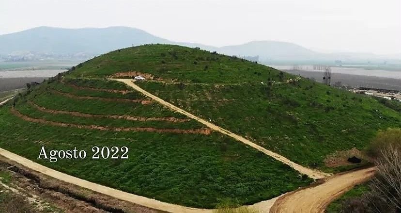
We have seen it work: on a hillside of compacted soil with no cover, thirteen months were enough for the vegetation to come back with nobody planting it.
Thirteen months later. Nothing was planted: it came back on its own.
First, knowing what can be reversed
Not all degraded land recovers, and none of it recovers the same way. Reading the property — soil, slopes, water, whatever vegetation is left — tells you what is reversible, what will take years, and what is better not touched.
That is where you get what no service catalogue will give you: the order. What comes first, what can wait, and what is wasted if it is done out of sequence.
The decisions are yours, and they arrive in stages
How much to intervene, where to start, how much ground to put into production and how much to let rebuild itself. None of those questions is purely technical: they depend on what you want the land for.
What we bring is the judgement and the consequences of each option, and we are there while the process runs — not only on the day a report is handed over.
The tools, and why they are not the starting point
The work starts with water. Infiltration ditches cut across the slope and force the water to stop and soak in, rather than run downhill carrying material away. Decompaction opens the soil so roots have somewhere to go.
Mountain microorganisms are collected from nearby native forest and multiplied on site: they are the life the soil lost as it degraded.
This is called passive restoration: instead of planting and then sustaining what was planted, the conditions are set and the vegetation returns on its own. Where the ground allows it, it is the option that asks least of you over the years.
The ditches follow the contour lines: they cut across the slope and force the water in rather than down.
Conserving is part of the job too
Not everything is recovery. On almost any site there are stretches that still work — a copse, a ravine, a band of native vegetation — and there the right move is to protect them, not intervene.
And what holds the result over time is connection: if the land stays linked to the vegetation around it, that is how seed arrives and how the animals that spread it move. A restored site on its own is an island.
What is not ours to do, and worth knowing
This is measured in years, not months. Thirteen months was fast: that hillside had forest nearby and a rainy season that helped. It is not the norm.
We deliver the diagnosis, the staged plan and the work itself, and we support the decisions as the process advances. Longer-term monitoring is agreed separately, because not every property needs it the same way.
And there are sites where this is not the right answer. If the soil has lost its entire fertile horizon, or the slope is unstable, we would rather say so before starting than halfway through.
What comes next
Restoring land is rarely a standalone commission: it almost always turns up alongside other decisions about the site.
Land survey
Measuring the site before intervening: area, slopes, water and access.
Property master planning
Where each use goes, so that what gets built does not clash with what is being restored.
Functional landscape
A landscape that, as well as looking good, produces, protects and regenerates.
Firescaping
Where the property borders forest, the ground around the house is designed to slow the spread of fire.
None of it has to be decided now. But if you are going to restore a piece of land, it helps to know from the start what you intend to do with it.
Book a meeting
Team · Urban planning architect and landscape designer
Fernando Montoya Giordano
He is the one who signs. That is the short version. The long one is that without his sponsorship your subdivision does not exist as a filing, so it is worth knowing whose signature it is.
He wrote the rules that later tell you yes or no
Before filing applications with the authorities, Fernando spent years on the other side of the counter. He coordinated the drafting of the Regional Land Use Plans for the Maule, O’Higgins, Atacama and Valparaíso regions, and of the Urban Regeneration Plans for six towns in the Maule after the 2010 earthquake.
When he reads a planning instrument he is not decoding somebody else’s text: he sat at the table where they are written. Knowing why a rule says what it says saves months when there is a case to argue.
He has regularised 250 lots that did not exist on paper
Chile’s Ley Tuma exists for that: bringing up to date subdivisions occupied for decades and never serviced. Fernando led the regularisation of Caleta Blanca, 70 lots — approved . Tres Peñas Alto is next, another 180 lots, in progress.
If you were wondering whether «we handle the paperwork» was brochure language, there are 250 lots of answer.
After the earthquake he had to measure a whole city
In 2010 he coordinated the survey and georeferencing of the physical damage in Constitución for the reconstruction plan. Recording a broken city, house by house, and leaving it in coordinates.
He kept a useful habit from it: to him a drawing is not a picture, it is a database somebody will have to use under pressure.
Over 70,000 m² of public parks, from design through construction
As landscape architect and consultant he has developed over 70,000 m² of park and public space design : Parque 17 Norte in Talca, Parque Los Troncos and the Mesa Seco master plan in Constitución, Plaza La Victoria in San Pedro de la Paz, the public space at Las Canoas in Mulchén, and the recovery master plan for a neighbourhood in Concepción.
And across the whole process, not only the drawing: bidding for the public funding, design, engineering packages and site supervision.
A park has a quality a private garden does not: everybody uses it, and somebody other than its designer maintains it. That forces you to design for the second summer rather than for the opening-day photograph. It is the same discipline he brings to a property.
The academic part, briefly
Urban planning architect. A master's in urbanism, taken in Barcelona, and postgraduate work in data capture and geographic information systems — so he was working with territorial data well before there were drones in this.
Twenty-five years teaching in schools of architecture, papers at international conferences, and two years of doctoral study in urbanism and land-use planning, in Barcelona.
He also runs a plant nursery
He founded and runs a landscape nursery in northern Ñuble. The planting palette on our projects does not come out of a catalogue: it comes from someone who grows the plants and watches them take or fail.
Alongside that he designs and builds private gardens, which is where you find out whether the landscape worked or only looked well on the drawing.
Does this apply to your land? The first conversation is exactly where that gets settled.
Book a call
Team · Survey, geospatial data and artificial intelligence
Rodrigo Garrido Bonilla
He is the one who measures. A computer engineer who has been flying drones since 2004 and modelling data for thirty years — two trades that sound unrelated until you open a survey up and find it is, above all, a data problem.
He came in through the audiovisual side, which teaches something else
Before measuring property he flew for television, film, security and inspection. He shot the aerial footage for three reports for a national broadcaster's newsroom , covered the opening of several football stadiums, and the opening match and two more of the Copa América in Chile . He also worked with the head of a film school.
That sounds a long way from a boundary drawing, and it is. But a live flight, with a crowd underneath and no second take, teaches you to settle the flight before taking off. You do not unlearn that when the job becomes a hillside.
He designed the first drone inspection plan for Chile's fishing coves
The first one for Sernapesca , the national fisheries service, to inspect coastal fishing coves from the air. Inspection is exactly that: seeing from above what cannot be seen from the ground, and recording it so that it stands as evidence.
A survey is, above all, a data problem
One flight leaves thousands of photographs and several million points. Turning that into a surface you can trust, with its error bounded and its coordinates tied to the ground, is processing — not photography.
But processing is only half of it. The other half is leaving the result in order : its reference system, its date, its accuracy and its origin all recorded, in structures you can query again, compare against each other and cross with whatever comes later. A loose figure serves once; a systematic one becomes information and still serves five years on.
Over ten years in drone and geodetic GNSS surveying : close to thirty surveys, several subdivisions, and more than thirty point clouds from the practice's own projects. Photogrammetric processing, digital terrain models, and surface area computed over the relief, which is not the same as measuring off the drawing.
Behind that sits a whole career in systems: data models for Chile's state bank and for the telecommunications regulator, a financial risk model for a bank abroad, electronic invoicing for a tolled motorway. A drawing, in the end, is a database with a picture on top.
He now works mainly in artificial intelligence, and that is where the two halves meet
Over three years in applied AI —computer vision, language models, agent-based development— and since 2026 he teaches it as well. It is not a separate subject: it is how he does everything else.
At ScanTerra that shows up in two directions. The first is the work that repeats : there are whole processes already automated and others on the way. Tasks that used to be done step by step now run on their own — what is left is checking the result, which is where a person is actually worth having.
The second is the data itself . A flight produces millions of points and hundreds of images: exactly the material a machine can classify, compare and count, and that by hand never gets finished. Separating vegetation from bare ground in a point cloud. Comparing two flights over the same hillside a year apart and measuring what changed. Counting individual plants across a planting.
And there is the difference from most of what is said about AI today: where the data comes from . Thirty years of modelling data teach you to distrust any result that cannot be traced back to its origin. Here the origin is points measured on the ground with geodetic GNSS and tied to real coordinates. The AI proposes; the measurement verifies.
That is what turns artificial intelligence, in this trade, from a concept into information somebody can check and defend. Which is what you will be asked for when that drawing reaches a public authority.
What he does not do, said plainly
He does not sponsor filings: that is Fernando's part, and he holds the qualification the rules ask for. Rodrigo measures, processes and delivers the base everything else is drawn on.
And no figure we hand you comes out of a model without somebody having checked it against the ground. It is a division of labour, not a gap, and we would rather say it than let it be assumed.
Does this apply to your land? The first conversation is exactly where that gets settled.
Book a call
Team · Regenerative landscapes and land planning
Erick Fernández Galleguillos
He is the one who knows what that soil will be doing in ten years. Over twenty years in ecological restoration, a trade where the result shows up late: you decide today for ground that does not exist yet.
Recovering a soil is not planting on top of it
Twenty years designing and delivering ecological restoration and regenerative landscape work. What separates it from planting prettily is that here you first ask what can be reversed, and sometimes the honest answer is that it cannot.
His own way of putting it: there are no single formulas . He works with a set of tools —agroforestry, syntropic agriculture, water management, soil biology— and decides which ones to use after seeing the ground. Bringing the recipe already written is what forces you to replant later.
He specialises in land planning and in productive systems that hold themselves up: the property should produce something, not only look well.
He grows the plants he later plants
Since 2010 he has run a native plant nursery aimed at restoration: propagation, living soil, adapted water management. It is a detail that changes the conversation — when someone proposes a planting palette knowing what each species costs to grow and how many of them die, the lists get shorter on their own.
And he does the same in the other direction: setting up municipal and community nurseries , so that native plant production sits where it will be used instead of being bought in every year.
Seven years teaching farmers to change model
Between 2016 and 2023 he was technical adviser on an INDAP programme with smallholder family farming: agroecological transition with people who live off what they produce and have no margin for experiments. That teaches you quickly to tell what sounds good from what holds.
Alongside that, trainer for public institutions and organisations, and before that environmental educator for a municipality. If a project needs someone to explain to the neighbour, to the maintenance crew or to a council what is being done and why, that part should not be subcontracted.
Green space you do not have to water costs less, and that is not a stance
Much of his municipal work runs along that line: bringing down the upkeep cost of parks and squares through native flora, low water consumption design and analogous plant selection. The argument is budgetary; the ecological one comes included.
He is the natural counterpart to Fernando's public parks. One designs the space; the other answers for whether it will still be alive in the second summer.
He can read a territory before anything happens to it
He works on socio-environmental risk management processes: wildfire prevention and mitigation, biological corridors, species inventories, ecological reading of the projects that arrive to settle on a territory.
He has worked as an interpretive guide in remnants of coastal native forest, alongside foundations. It sounds anecdotal and it is not: recognising species by species what stands on a hillside is exactly what you need in order to say what can be touched and what is better left alone.
Where he learnt this, in short
Landscape design and landscape ecology as his base training. Then a specialisation in syntropic agriculture in Brazil , permaculture design, and twenty years of courses in agroforestry, integrated pest management and regenerative hydrological solutions.
In between, two years in New Zealand: landscape work in Auckland and specialised agricultural work in wine country. Seeing another climate, other species and another way of working the land is the kind of thing you do not study.
Both his name and Fernando's appear on the landscape sheets. That is not a formality: the planting palette, the living fences and the agroforestry systems come out of that argument, and it shows when one of the two is missing.
Does this apply to your land? The first conversation is exactly where that gets settled.
Book a call
Team · Environmental law and socio-environmental disputes
Santiago Pinedo Icaza
He is the one who reads the paperwork before it is too late. On rural land the problem is almost never the land: it is what the title deed says — or fails to say.
That the property matches its registered title
Checking a title is not just pulling the current ownership record and the mortgages certificate. It is confirming that the seller really is the owner, that the chain of title holds up, that no third party has rights over the property, that there are no restraints, no litigation and no debts, and that any building work and subdivisions have been properly authorised.
And one more check, which at ScanTerra carries particular weight: that the property you are physically buying is the same one that is legally registered . It is the problem we run into when we survey, seen from the other end — we reach it with geodetic GNSS; he reaches it through the register.
When those two views fail to meet is when the expensive surprises show up: an immaculate plan over a title that will not hold, or a clean title over land that does not measure what it claims.
Looking after relations with the neighbours
A project out in the country is almost never argued out with a public authority alone. It is also argued out with whoever lives next door, with a community, with a group that has already organised itself — and those conversations have rules of their own.
His speciality is managing and mediating socio-environmental disputes : steering that part before it breaks, rather than drafting the filing afterwards. It costs less and it usually ends better.
In a single line
Lawyer, specialising in environmental law and in the management and mediation of socio-environmental disputes.
That is what explains why he can do the above.
Does this apply to your land? The first conversation is exactly where that gets settled.
Book a call